Cartographers of Sri Lanka, or Ceylon, as it was until recently known, have been in a more fortunate situation than those of Africa. Because of its geographical position on the ancient sea routes to the East, and its colourful reputation for elephants, spices and precious stones, Sri Lanka was well documented in the ancient history of the Romans and Greeks, Persians and Arabs.
The island was known as Lanka to the Indians of early times, as is recorded in the epic poem, the Ramayana. The Arabs called it Serendib, and in maps of the seventeeth century it was named Selen-diva (meaning the Island of Selen or Seren); it is not too dificult to see how this title yielded, in time, to Seylan, Ceilao and Zeilan, and finally to the more modern name, Ceylon. The Greeks and Romans called it Salike after Ptolemy and also Taprobana, from the Tamba-panni of the Indians.
By the middle of the nineteenth century Ceylon had been mapped in practically all its major detail. The British mapped the harbours of Trincomalee and Colombo for naval purposes, and numerous details from these map were added to subsequent general maps of Ceylon. The Tallis map of 1850, with inset vignettes of scenes of Ceylon, is a good example of the cartography of the time. Survey Department maps from this period onward provide increasing detail of village areas and ruined cities.
The shape of the island shown in maps changed with the accumulation of knowledge - from the triangular shape Ptolemy ascribed to it in the second century A.D. to the pentagonal and rectilinear shape of the sixteenth century, and finally to the tear-drop shape of the nineteenth and twentieth centuries.
The first map of the new Republic of Sri Lanka will be seen as the culmination of an astonishingly rich cartographic tradition.
 |
|
The Sebastian Munster version of the original map of Taprobana by Ptolemy, who also called Ceylon Palaesimundu and Salike. The artist added the elephant design.
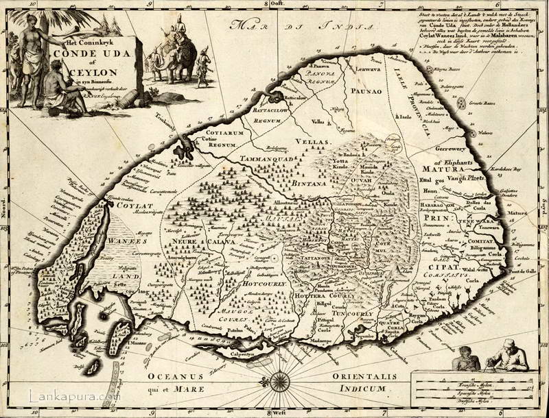 |
| Old Map of Sri Lanka c.1692 |
 |
One of the rarest Ceylon maps existing is this ornate mariners' map by Doncker, published about 1660.
|
 |
| VOC Map of Colombo and surrounding |
 |
| Antique Map of Ceylon, Ceilan c.1630 |
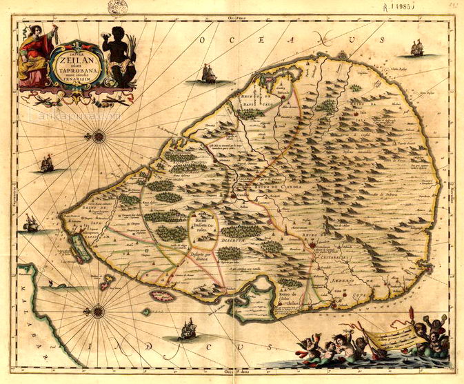 |
| Isle of Zeilan, Old Map of Taprobana |
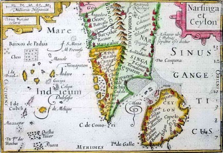 |
| A Bertius map of South India and Sri Lanka |


